
Monday, June 10th, 2019.
Day 10 of Trekking the Huayhuash Circuit by G-adventures
Todays plan:
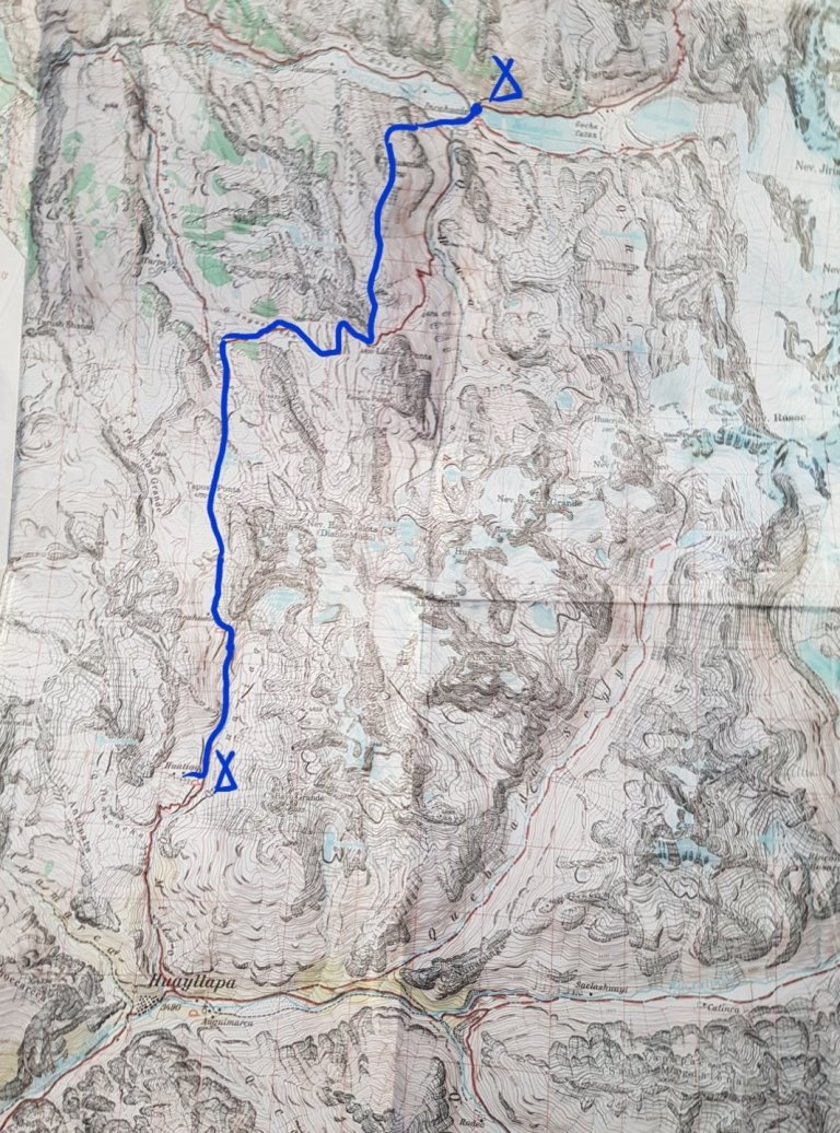
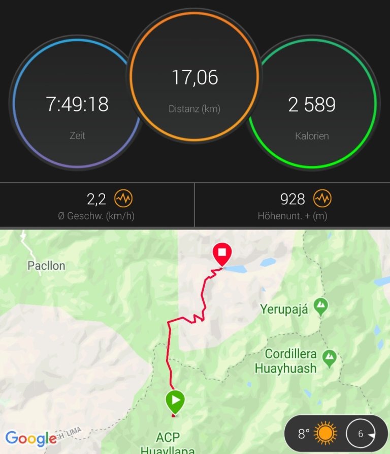
“Huantiac to Laguna Jahuacocha, 8 hrs
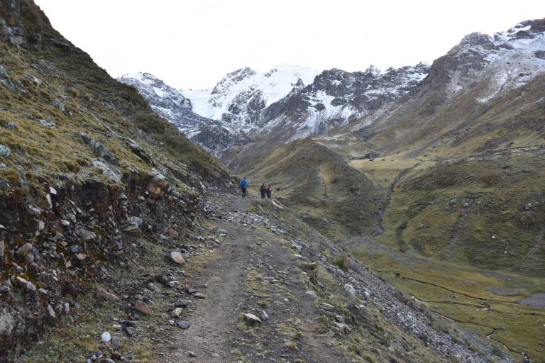
Descend into Angoshcancha valley passing through quenoal forest before climbing up to Yaucha pass. Enjoy beautiful views and keep an eye out for condors on the way to Laguna Jahuacocha.
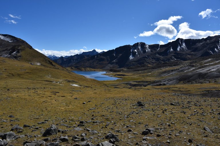
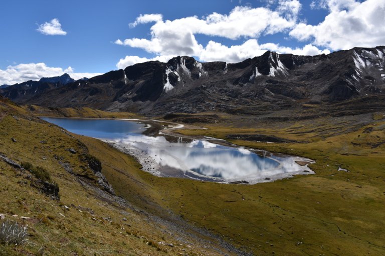
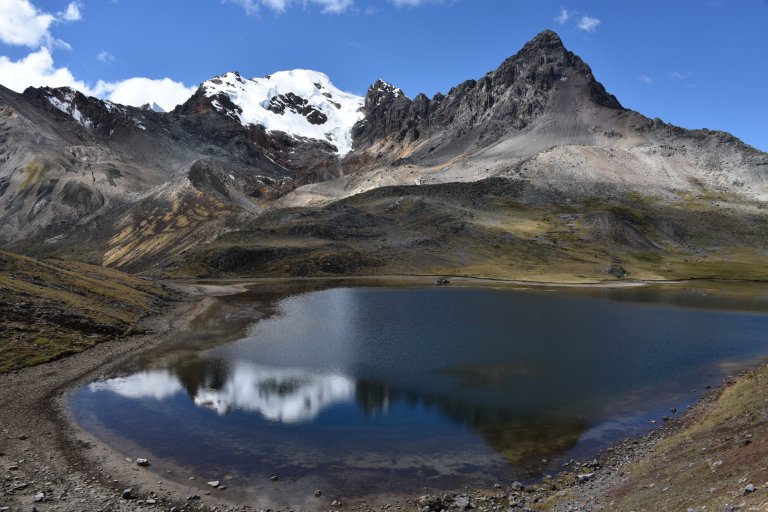
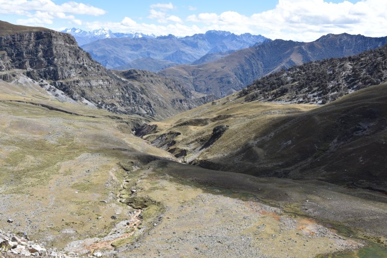
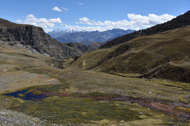
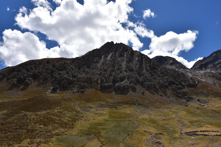
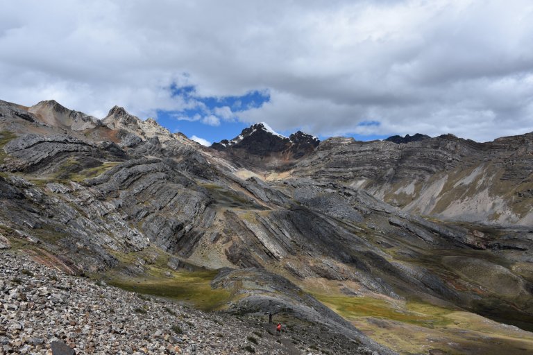
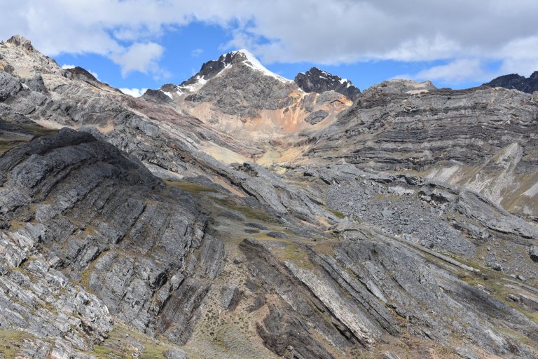
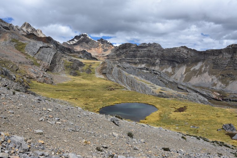
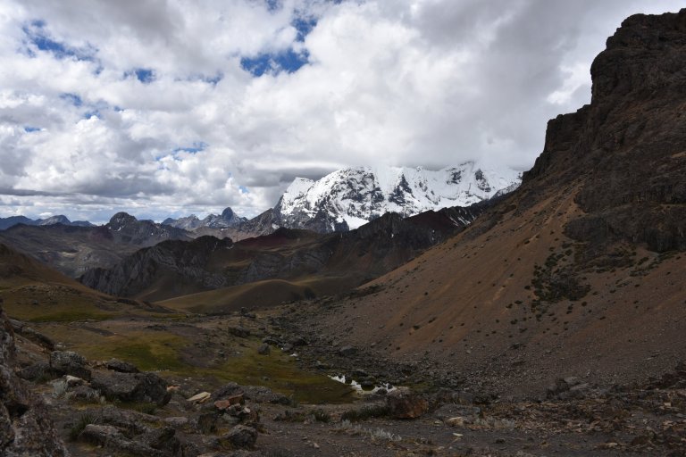
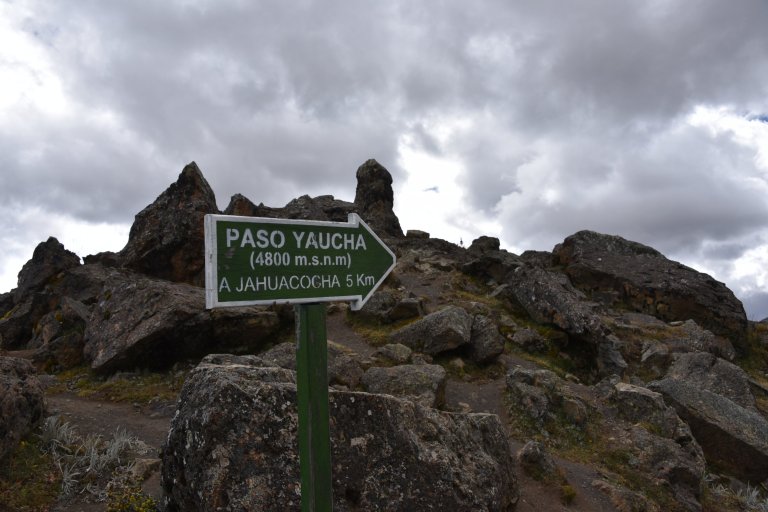
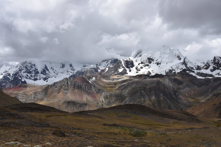
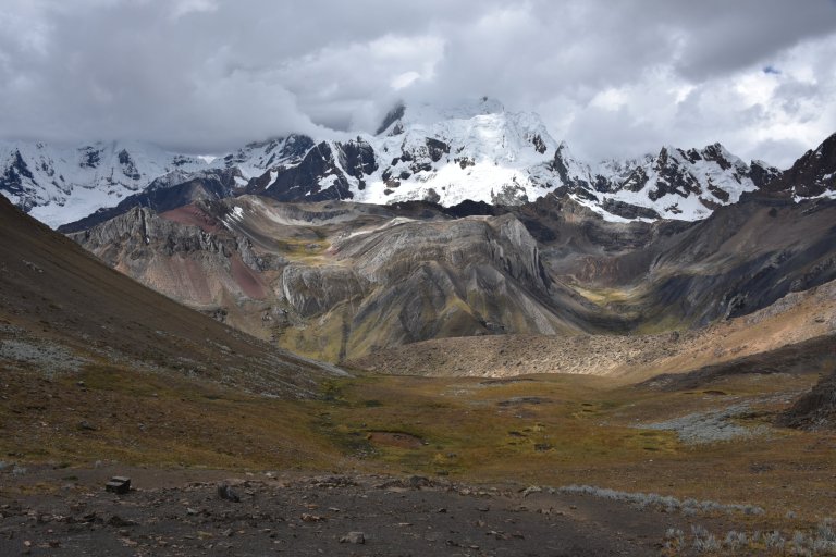
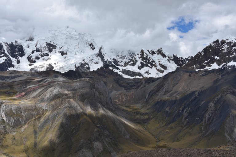
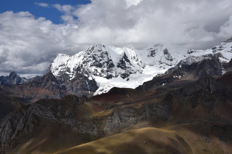
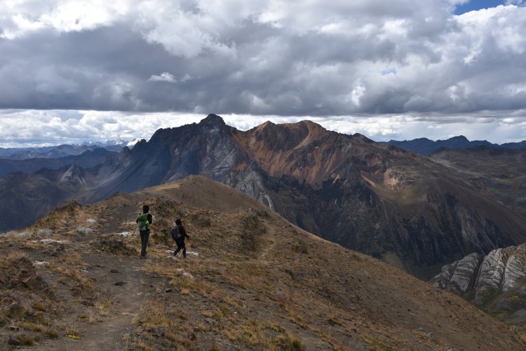
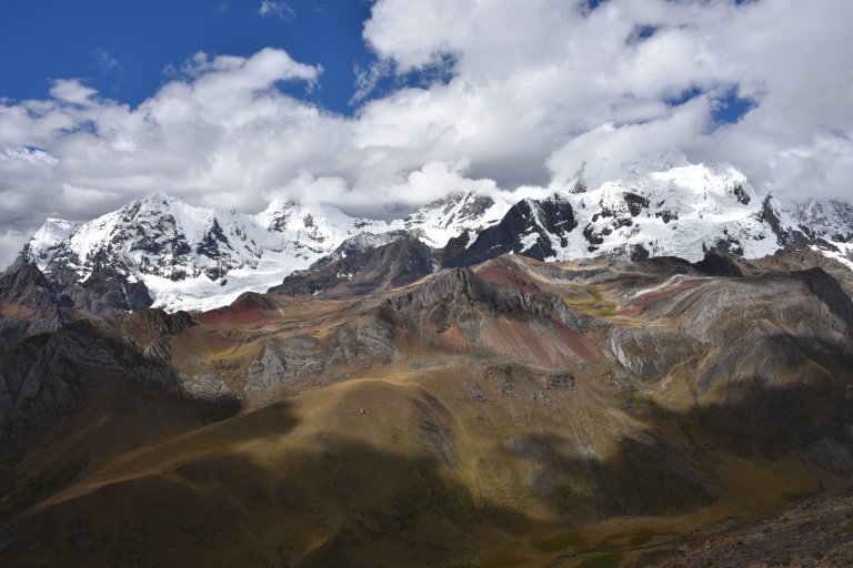
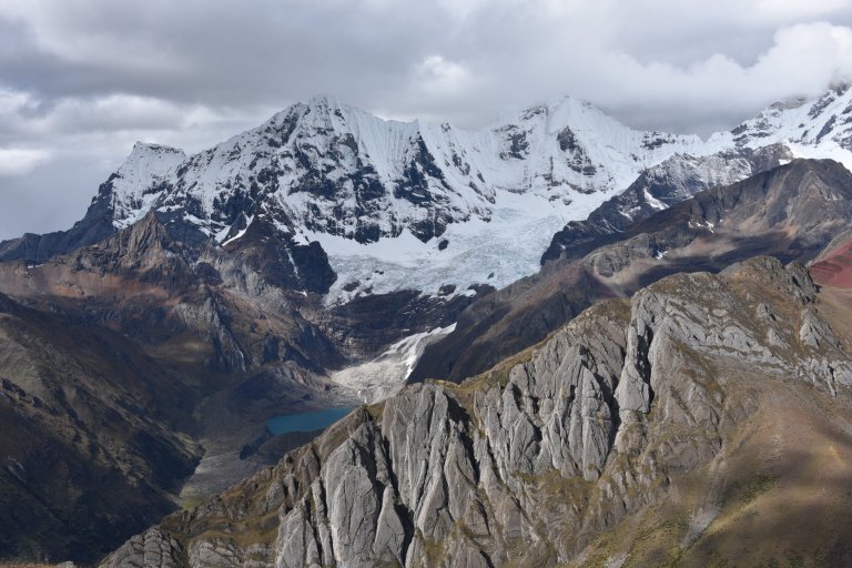
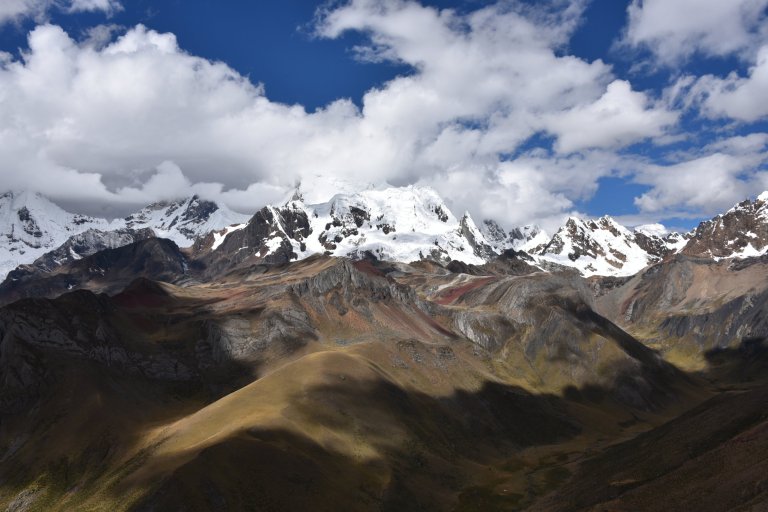
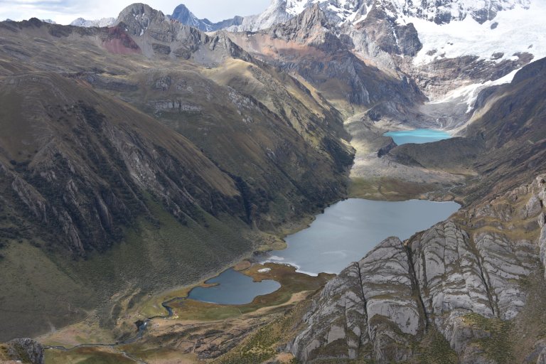
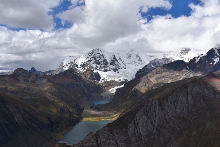
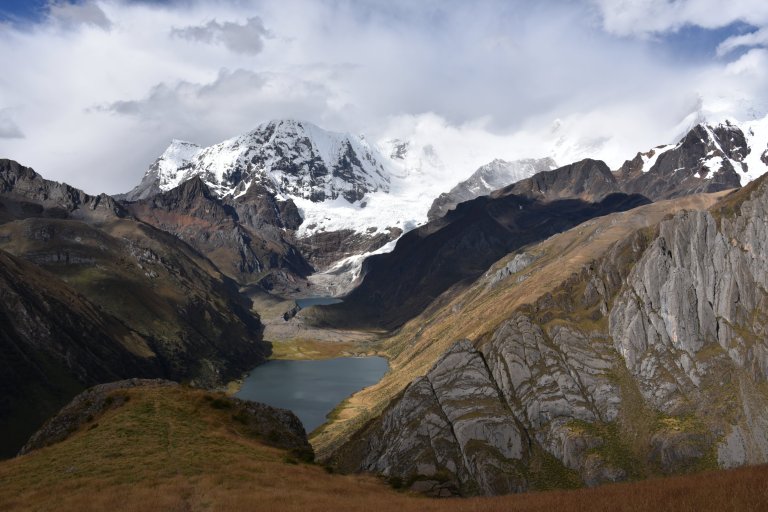
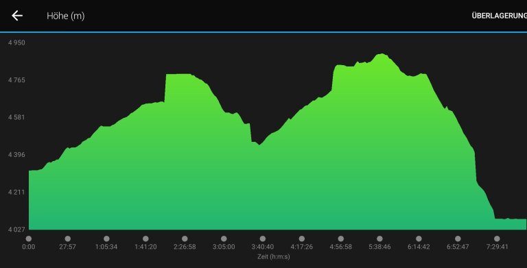
Descend down into Angoshcancha valley, through the scraggly quenoal forest. Head back up a steep incline to Yaucha pass (4800m/15748 ft). On a clear day, there are magnificent views of the highest peaks of the Huayhuash range and long-distance panoramas to the peaks of the Cordillera Blanca. This is a good place to spot the majestic condor. Head back down to Laguna Jahuacocha, thought to be the scenic gem of the whole range (4,050m/13,827 ft).”
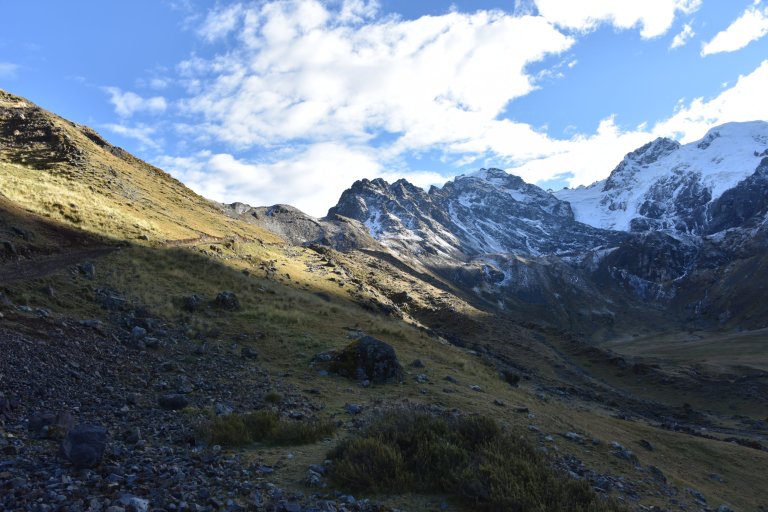
06:30 am. A clear nicht after the rain. The grass is super wet and muddy. At least not frozen.
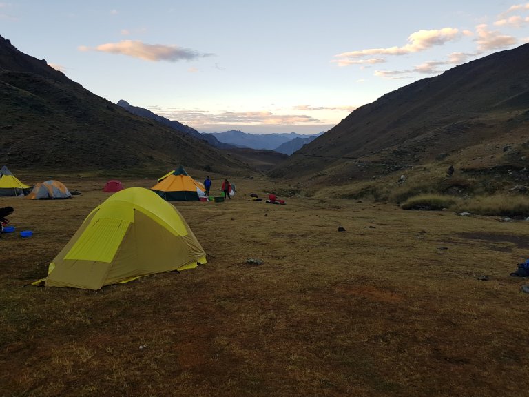
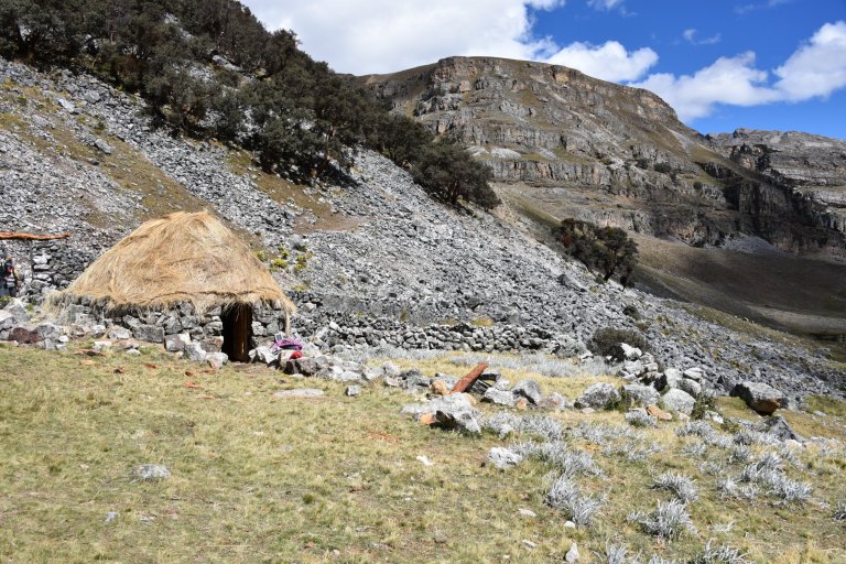
Huntiac Campsite, 07:30 am, 4.329 masl
10°19’32.7″S 76°59’41.0″W
ACP Huayllapa, Peru
Google Maps
The longest day, Lucy said. We start earlier than usual. 07:30 am, Lycy says “vamos”. Surprisingly everybody is in time. We walk up …
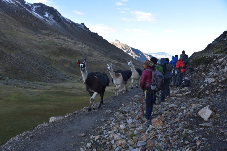
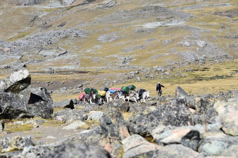
Not more than an hour later the Llamas with our duffle bags pass by running followed by the Llama lady on a horse.
Sun gets out. It doesnot change the temperature nor the wind.
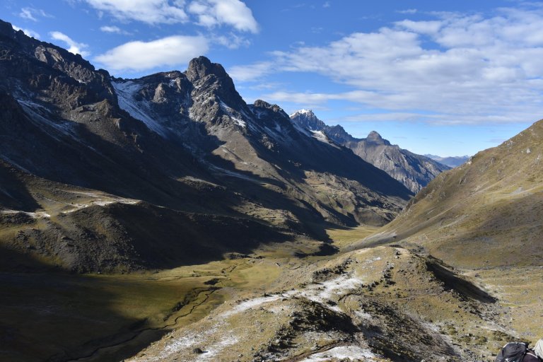
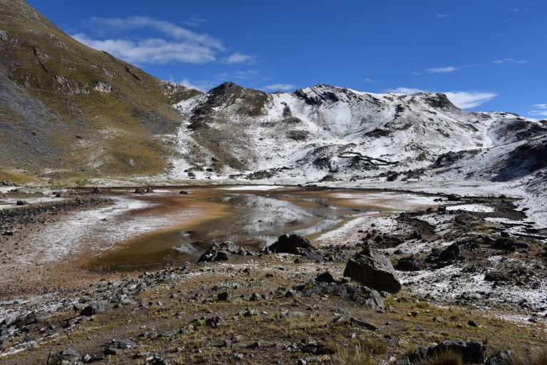
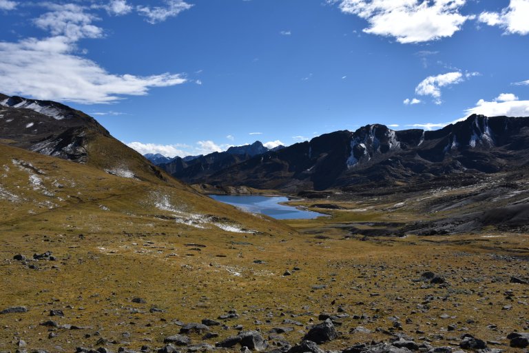
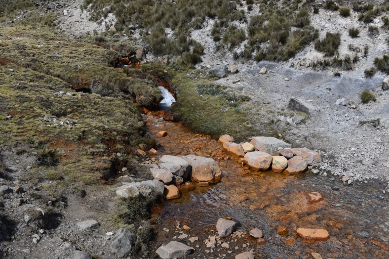
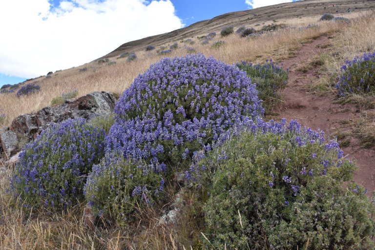
The higher we get, the more the rain turned into snow and stayed, where the shadow is. Colors are wonderful in the sun. The different minerals color the lakes red, brown, blue or green.
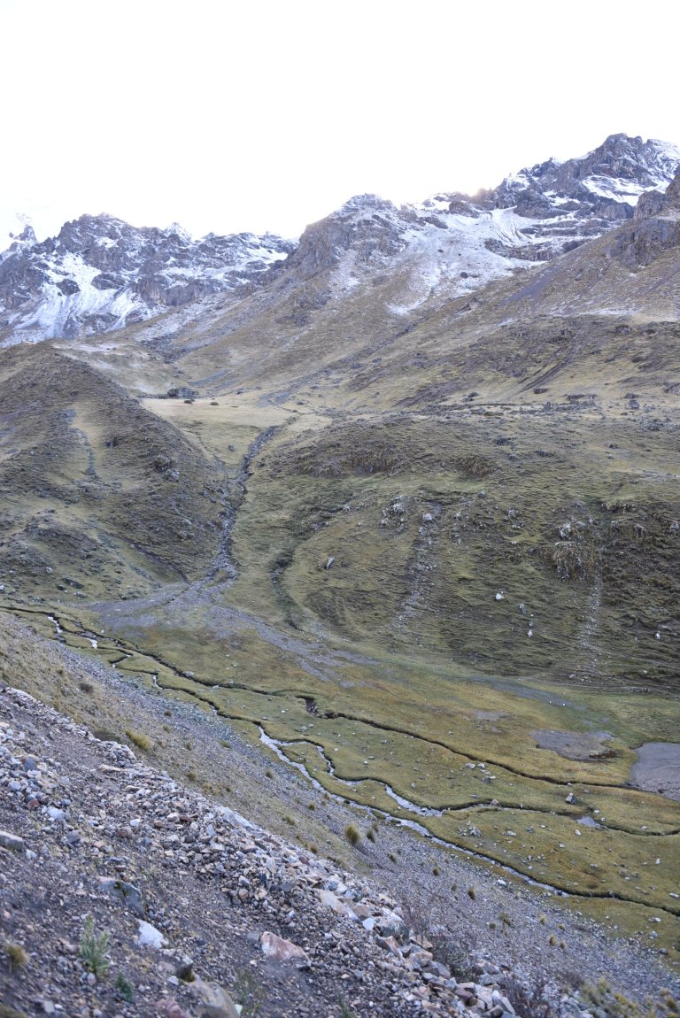
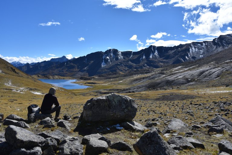
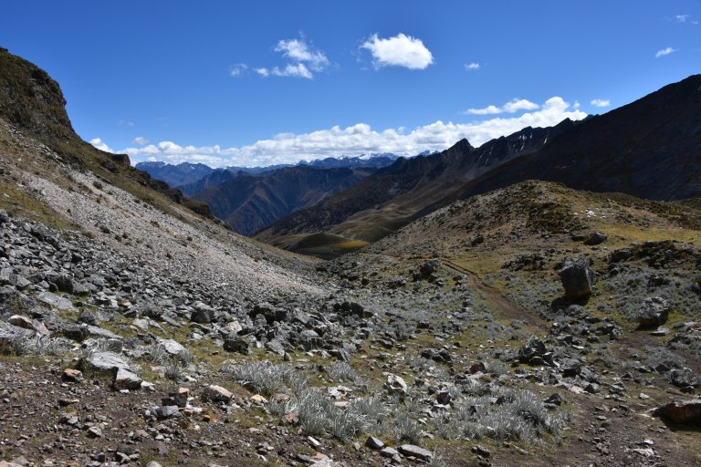
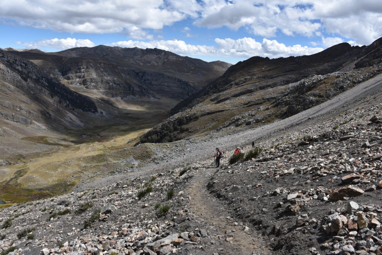
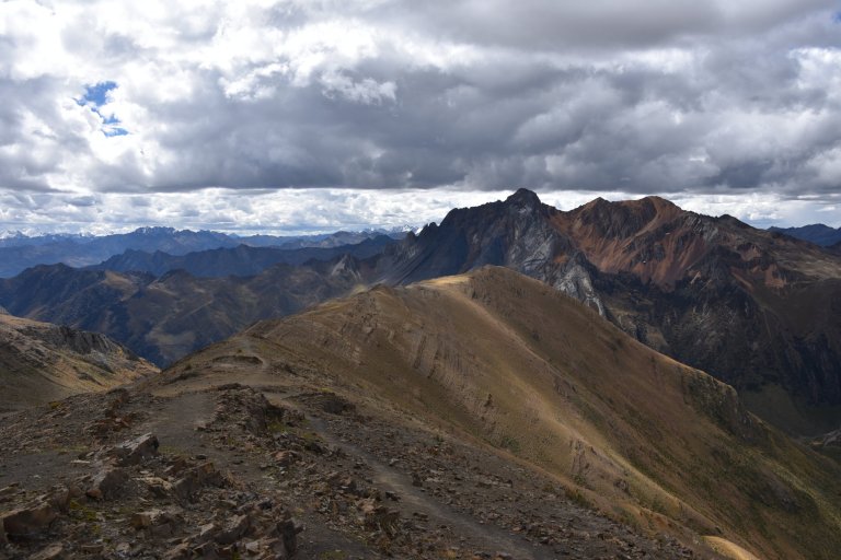
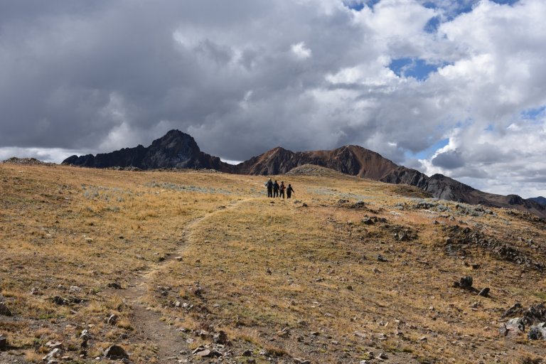
We reach the pass and look into a slow descending valley. We make a break. Nobody takes off a layer. The girls look for stones, big enough to hide behind them for baños stop.
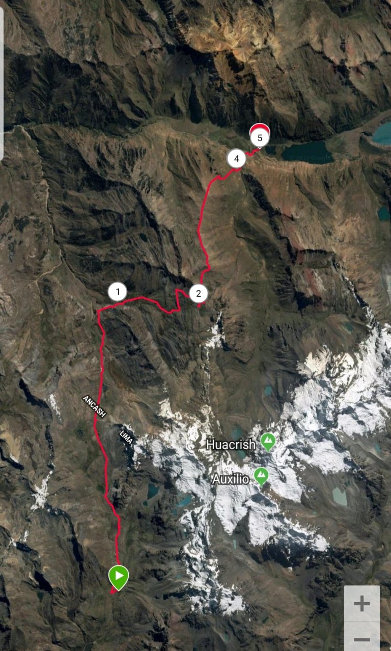
Tapush Pass, 09:26 am, 4.660 masl
10°17’28.0″S 76°59’56.5″W
Copa, 15197, Peru
Google Maps
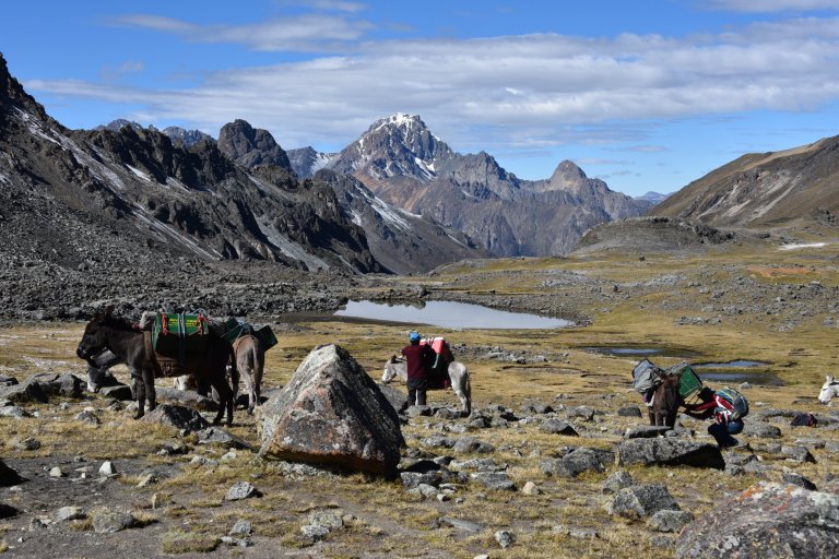
The donkeys with tents and kitchen equipment arrive. They make a rest, too.
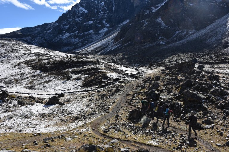
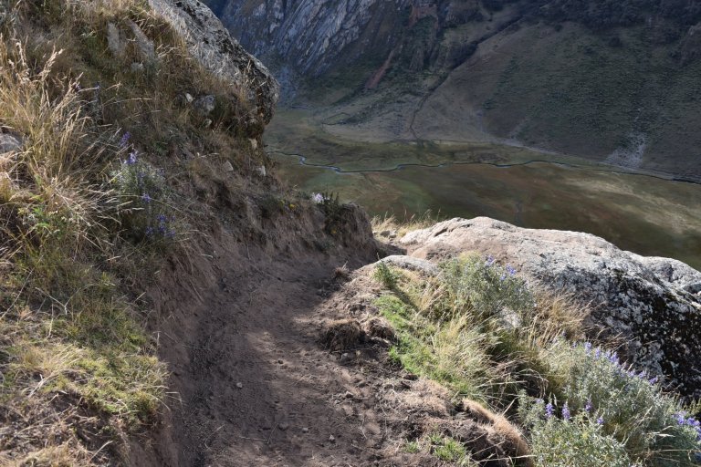
We continue our hike downwards.
A lot of water and water crossings. I am happy to got my high salewa boots.
Down, down, down. Finally it gets warmer and vegetation gets more dense.
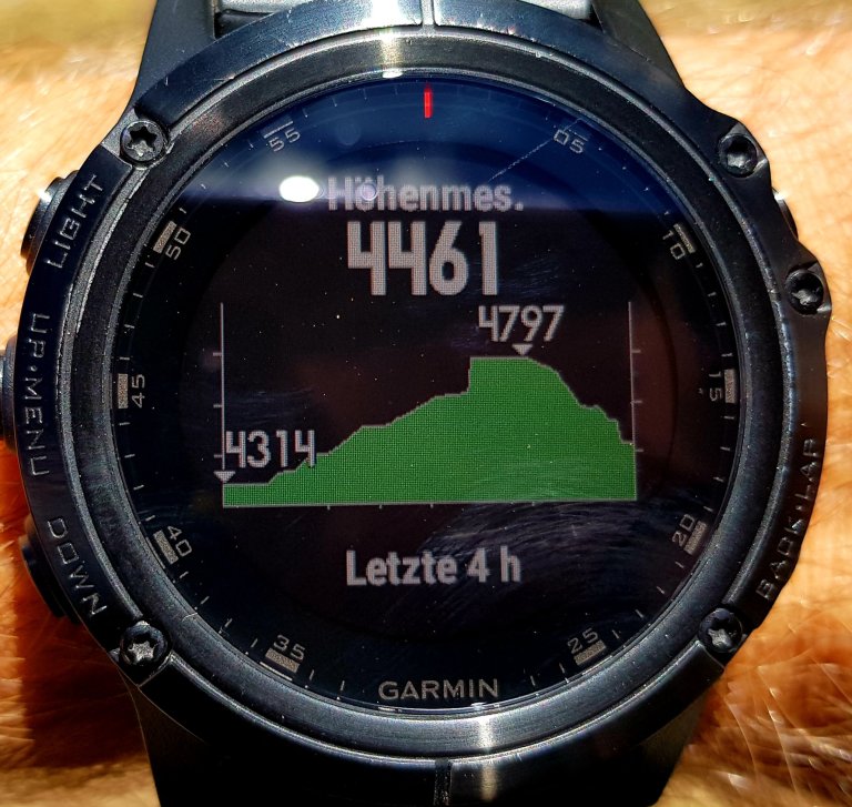
Checkpoint, 10:58 am, 4.461 masl
10°16’04.2″S 76°59’40.9″W
ACP Pacllon, Peru
Google Maps
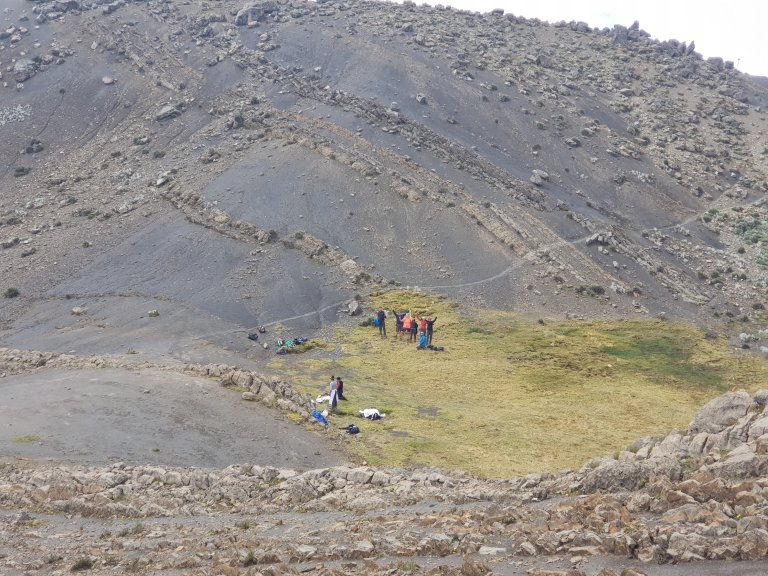
An indigenous woman and her kid are checkin if lucy got all the papers and paid. Then she gets a signature.
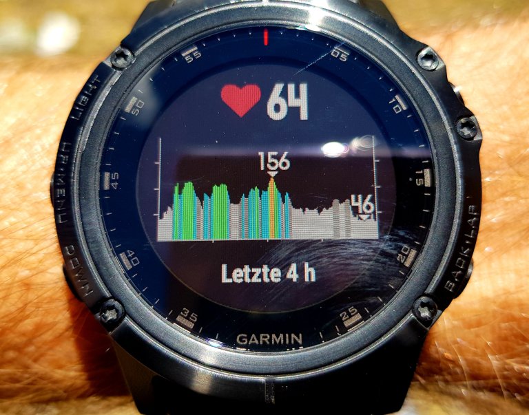
The ups and downs push my heart rate. If I run at home 15ks I never reach over 150.
We stop beneath Yaucha Pass in the Lee of the pass to have lunch. There is cellphone signal. Good signal. Even fast (H+) data connection. Sad faces. Most people have their cell phone in the Llama duffle bag. I am continuously vibrating. I send WhatsApps home.
Lunchbreak, 11:46 am, 4.568 masl
10°16’10.2″S 76°59’03.5″W
Pacllon, 02426, Peru
Google Maps
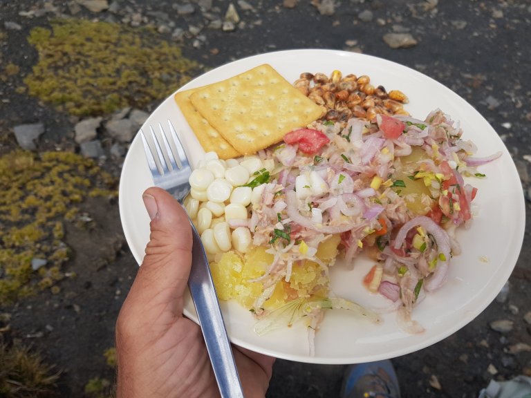
The cooks are already there. They carry our lunch in huge back bags, run up every day and cook. Mostly it is the best food of the day.
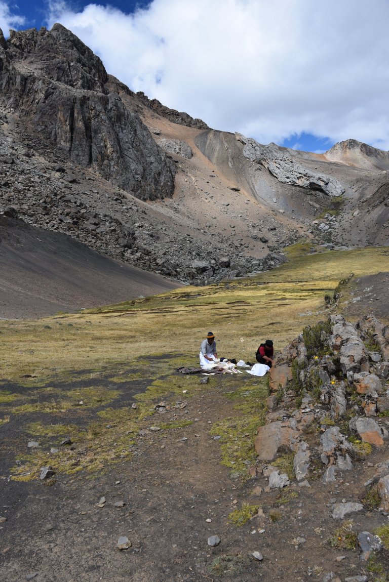
Today it is. Sensational mountain ceviche.
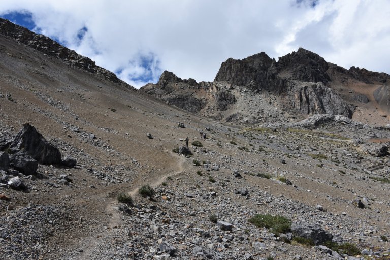
We start to hike up a little bit further to the pass.
Llaucha Pass, 12:40 pm, 4.841 masl
10°16’05.5″S 76°58’41.2″W
Pacllon, 02426, Peru
Google Maps
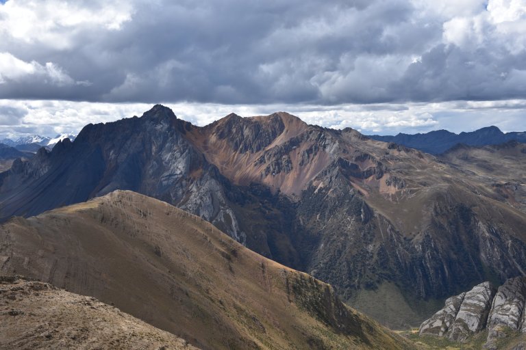
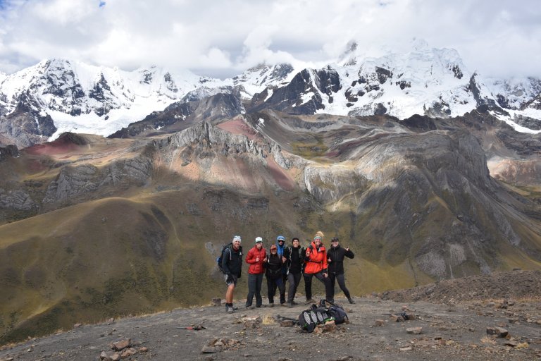
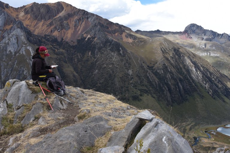
Then we have to decide, go down in the valley to the river and follow it to the campsite or optional climb up once more to the rim opposite Huayhuash, walk on the rim and later go very steep down. We decide to optional and go up once more. Only half of us does.
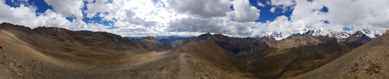
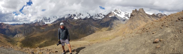
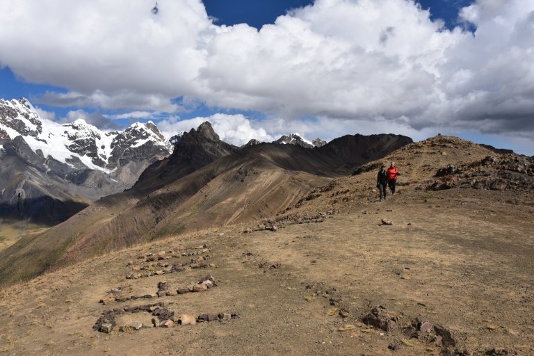
Lucy runs up. After a short but steep ascent we reach the rim. Breathtaking views on cordillera huayhuash are the reward.
The Rim, 14:00 pm, 4.886 masl
10°15’36.9″S 76°58’33.3″W
Pacllon, 02426, Peru
Google Maps
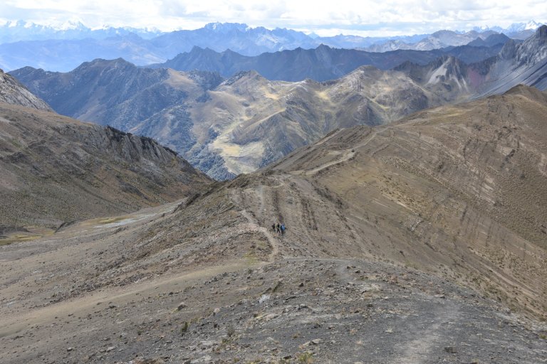
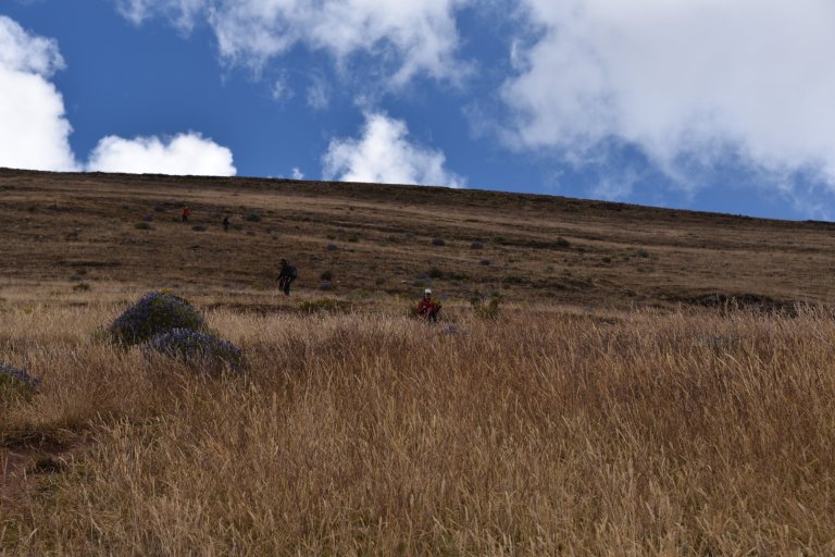
Then we are on an edge and start the steep descent in zig zag to the valley of our last campsite.
At 16:00 pm we reach the valley.
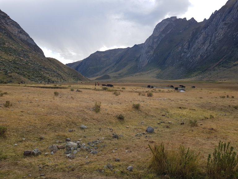
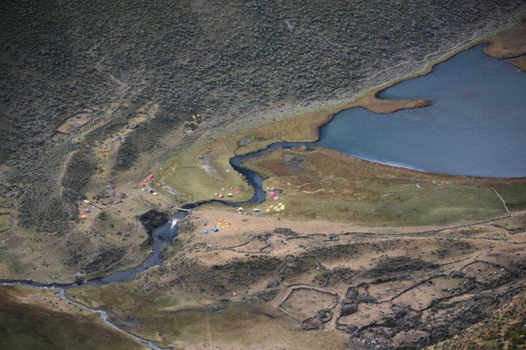
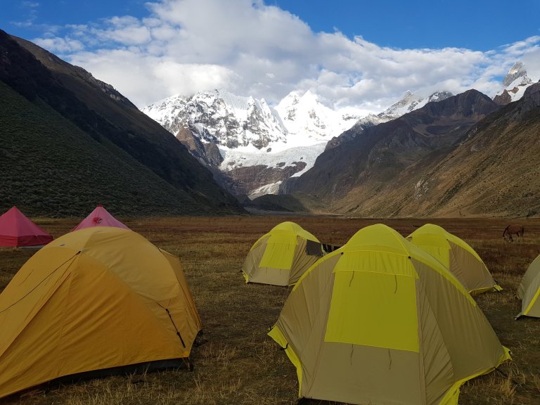
Laguna Jahuacocha Campsite, 16:00 pm, 4.080 masl
10°14’12.4″S 76°57’56.2″W
Pacllon, 02426, Peru
Google Maps
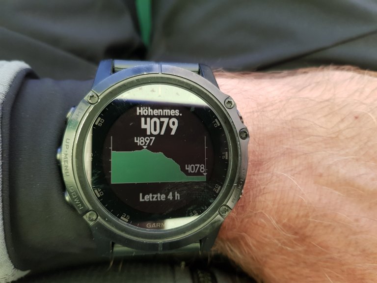
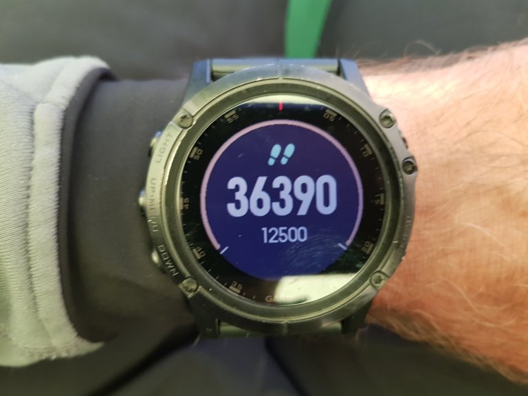
Some steps done today.
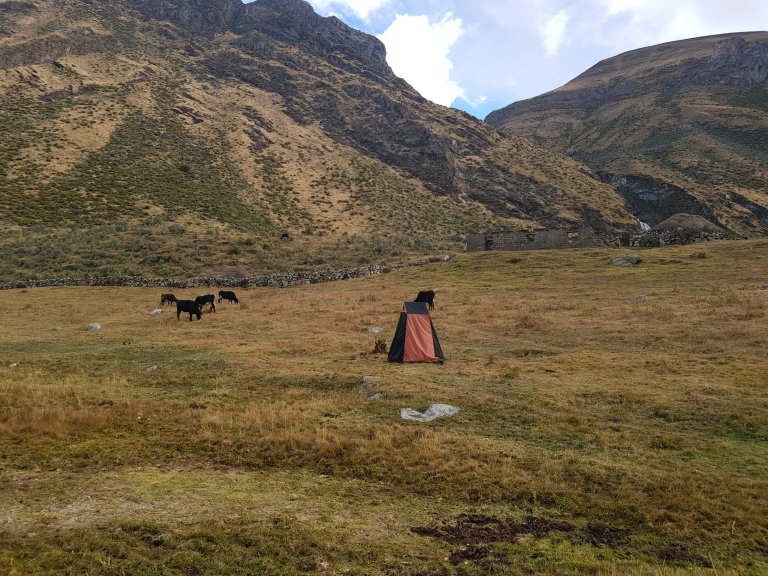
The toilet tent is built up on the cattle ground. It would not make a difference to loose your digestion on the way. Every brise of wind flaps it down. I decide to wait for improvement.
The view from my tent is marvelous.
Qwirkle time
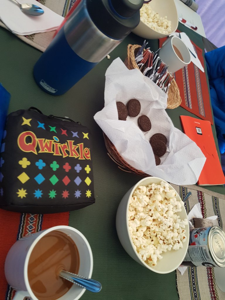
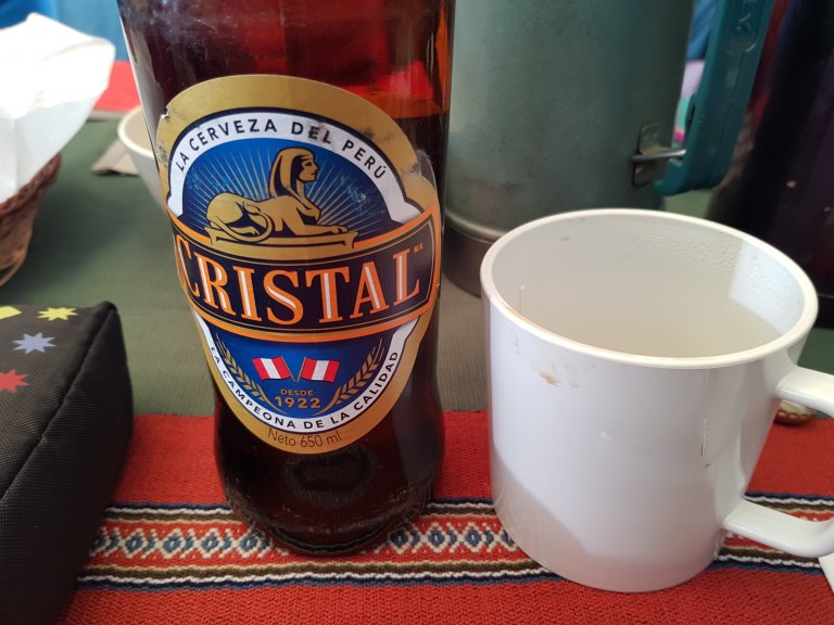
A indigenous woman sells beer at criminal prices. Nobody complains. Rule is, you have to bring the empty bottle back.
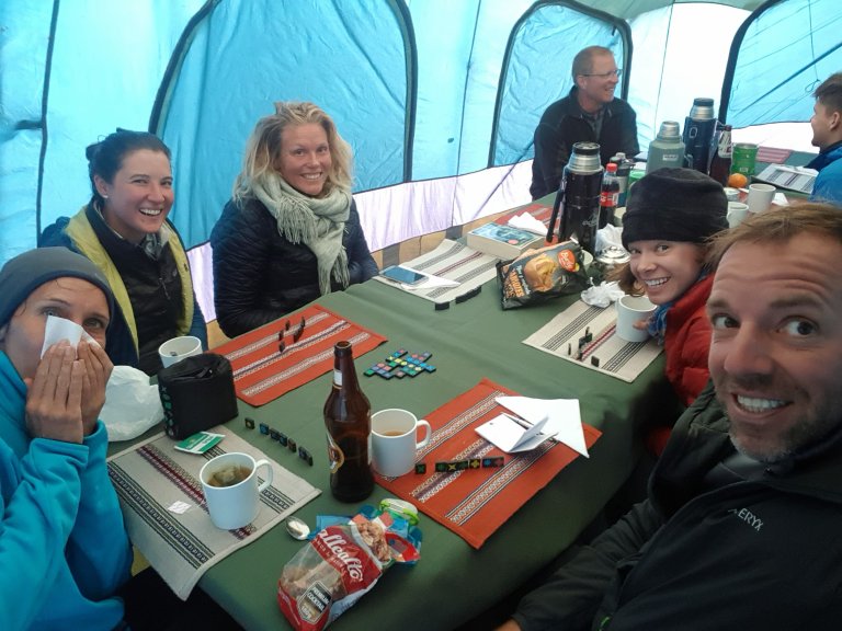
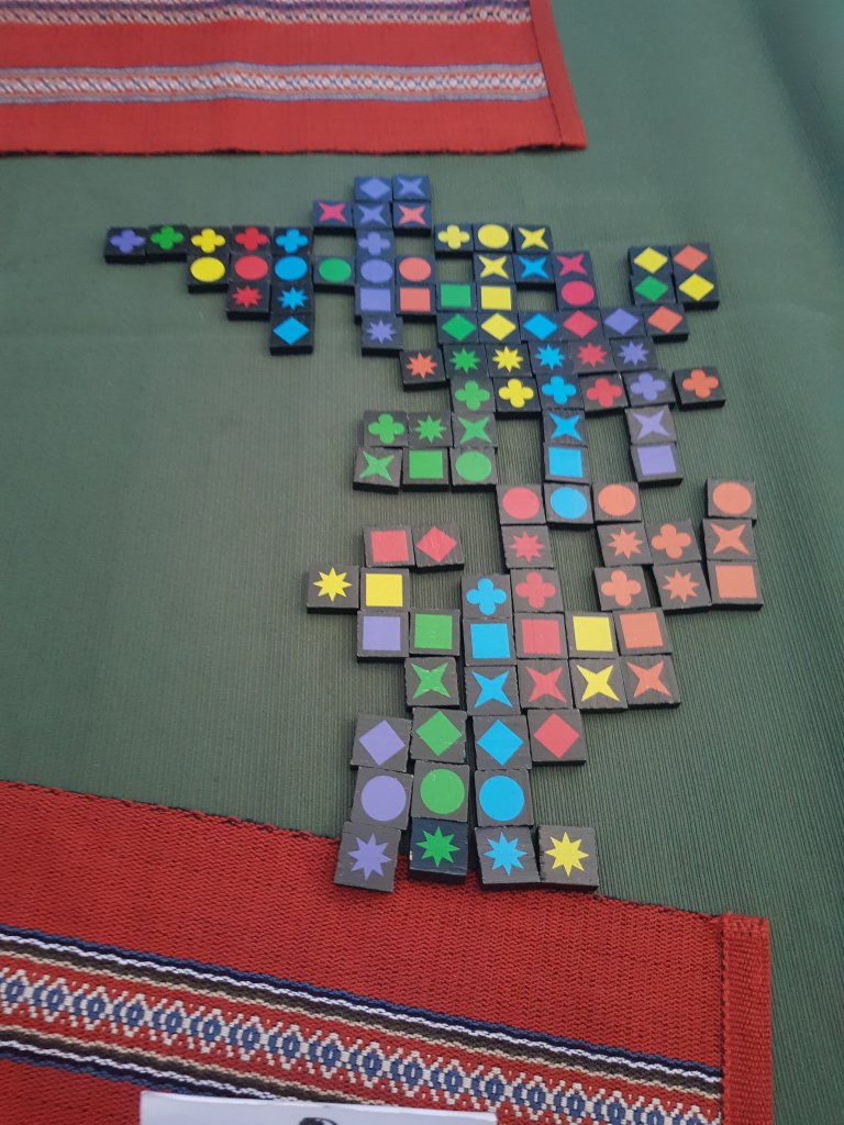
Of course I win.
Accomodation: Laguna Jahuacocha Campsite
